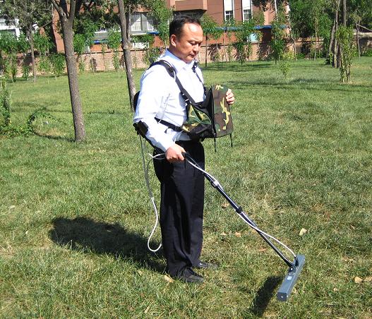
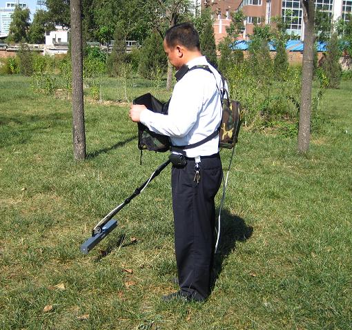
上面为开拓者探地成像仪水上探测视频
上面为开拓者探地成像仪全方位探测演示视频
开拓者地下成像仪,是我公司最新引进美国精密探测仪器公司的高科技产品!是目前唯一可以探测所有金属以及地下空洞,瓷器,管道等非金属异常信号的仪器。具有定位精确,能探测物体的形状及深度的功能,操作简单,携带方便,是目前工程,矿产,考古研究最佳的选择!本仪器正在促销,详情可拨打销售热线010-82050316进行咨询。
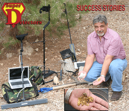
黄金勘探杂志综述:
“黄金勘探者”杂志于2006年1月和2月的两期刊物中发表了有关开拓者探地成像仪应用的文章。Jim Klein在“精确测试定位仪器--一次现场测试”的文章中,描述了如何使用开拓者探地成像仪寻找黄金的情况。
'现代勘探的挑战'
开拓者探地成像仪多传感仪器是多个传感器的排列状态,能够产生非常可靠的采样率,有效的深度最深可达200英尺。探地成像仪对于公用物体的定位和专业的寻宝者都非常适合。探地成像仪安装的先进软件比现有的其它品牌的操作更加简单,而且此软件是含在价格之内的,无需支付额外的费用。
'令人激动的发现'
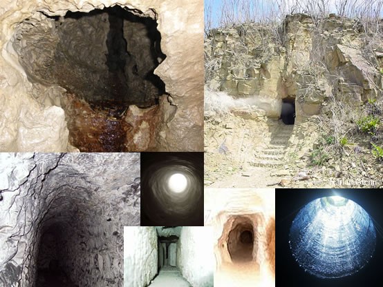
这个Magnum拥有两探头的传感器天线,这是专为定位较大物体而设计的,包括埋藏的宝藏,岩洞,隧道和空洞。带有3D成像软件的双探头Magnum和基本型、标准型和精密型的成像仪都可以实时的看到地表下的物体。Magnum可以在适合的地理环境下接收到一个高的采样率,因此可以探测到120英尺下的较大的物体和地道。探地成像仪本身自带一台预设的小型电脑,控制仪,传感器机架,套管伸缩轴,电池,充电器,所有的连接电缆线,带有Camelbak私人水容器的自定义的双外包装,携带式拉杆箱,视频,用户手册,两小时技术支持或预约培训(现场)和一年的保修期。Magnum 是众多探测爱好者和寻宝者的选择。
'地质勘探软件'
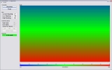
地质探测软件是专门为探地成像仪开发研制的。这个软件是本着使用简单的理念开发的。此软件有同时显示标准2D顶端视窗和3D侧面信息显示。先进的过滤技术也提高了图像的清晰度从而可以更好的识别目标。探地成像系统是完全由地质勘探软件控制,为操作员进行快速、轻松扫描而设计的。
这种软件内含3D成像、用户自定义设置、出厂设置来实现快速分析和目标识别的。探地成像仪的基本型、标准型和精密型的最显著之一就是具有“实时直播模式”。实时模式的使用者可以在任何方向实现对不规则物体的定位。它的独特性是可以得到令人惊讶和全屏观看的行使的速度,如果你喜欢的话还可以跑着测量。
探地成像仪的技术已经在各种气候和地理环境中由专业人员和业余爱好者成功试验过了。应用范围包括考古学、地球物理学、地质学、水文地理学和寻宝。勘探的范围包括工业废料场、废品堆积处、建筑地、采矿区、街道施工地点、军事演习地、和其他地表的探测。
探地成像仪的外包装都是为顾客的使用方便着想而设计制作的。不仅为您的装备 ,还为你的电脑、控制仪及电池设计了足够的空间。包装受力均匀达到平衡,几乎没有压力,背起来比较舒适。探地成像仪的外包装有不同的颜色和两种大小型号,这取决于电脑尺寸的大小。
手推车是作为标准型,精密型和基本型的配件出现的,它可以装载扫描仪以及放置所有的装备和额外的电池,从而实现在场地进行更长时间的扫描。
带有肩带的天线盒可以容纳多达三个天线从而起到保护作用。规格同标准型和精密型仪器一致。可选其它型号。
经济型基本型标准型精密型预置软件的笔记本电脑xxxx双通道控制单元xxxx测试包xxxx测试接头Wiring Harnessxxxx电缆xxxx24V电池组xxxx24V充电器xxxx软件xxxx视频xxxx延长棒xxxx用户手册xxxx技术支持xxxx搬运箱xxxx天线箱 xx10' 天线x 20' 天线 xx 24' 天线 x实时测试模式 xxx精密定位 xx天线选件12' 天线 xx 20'天线x 36'天线 xxx
新型双通道控制单元新探测速度自动大地均衡可装备在船上和汽车上探测埋藏的宝藏市政探测速度:28.8公里/小时地表水探测可探测15米的隧道和洞穴矿石探测 搜寻失事船只金属和矿产探测采矿应用地下不规则物体的探测最新应用软件最新6'和8'天线在拉斯维加斯和美德福德拥有演示基地紧凑和轻便选件:手推车2小时的技术支持和培训操作简单
一、开拓者 探地成像仪简介
开拓者探地成像仪是一种利用探测地球电磁场遇到不同介质而产生的变化来实现三维图象的探地测量仪器。它不需要发射信号到地球,而是利用地球内部已经存在的地球电磁场信号,防止了普通探地雷达的大功率发射信号对人体和环境的影响,同时也不受外部环境的干扰,适用于各种复杂的环境。
开拓者探地成像仪使用方便,成像清晰,层次分明,立体感强,判断准确,是现在市场可以同时实现金属物体和非金属物体探测的地下成像探测仪。
开拓者探地成像仪由于其优良的性能价格比,广泛应用与地下金属管线和非金属管线的探测、废旧物和污水池搜寻、道路施工验收、军用未爆破物搜寻、楼房基础探测、水下各种物体和大坝管涌的搜寻和考古研究。除了在平坦的场所应用,而且可以用于山道、水面等区域。
开拓者探地成像仪的探测速度是其他探测仪无法比拟的,他可以与汽车和快船一起使用。探测质量和数据分析能力也是其他种类的成像探测仪所不及的。
【特点】
开拓者探地成像仪是现代唯一能同时发现所有金属和非金属物体的探地仪器,其最大探测深度可达15米。它可以通过手持、便携、手推车、车载、船只对各种环境进行地下成像探测,主要应用有:
◆环境监测:探测各种用于偷排放污水的各种地下金属管线和非金属管线,隧道、污水池。
◆市政建设:探测出各种金属和非金属管道和管线,以防止道路施工造成管道的破坏。
◆石油行业的物探:可以同时探测金属管道和PVC管道。
◆矿产探测:各种地下矿藏、堆积砂矿的探测。
◆大坝管涌的探测:大坝管涌是由于大坝内部被掏空而形成,可以采用手持和车载等方式在大坝上快速进行探测,可以很及时地发现将要发生大坝管涌的位置。
◆水下探测:水面下金属和非金属物体、管线走向,矿藏,沉船,污水池和故障点的探测。
◆考古探索:古墓和宝藏与周围环境有明显的不同,可以用用开拓者探地成像仪对可疑地点进行探测。
◆房屋地基的探测:进行房屋建设前的地基探测,探测出地基下存在的洞穴。
◆军事应用:对演习地和相关地点进行未爆炸物的探测,由于没有发射,不与地面接触,所以十分安全。
【主要技术指标】
1、控制单元
控制单元电源电压范围 12-38VDC
控制单元工作电流 250mA
控制单元处理器 AMD 133MHz ELAN SC520
操作系统 Linux
存储器 32 MB SDRAM
工作温度 -20°C - 60°C
数据传输率 100 MB/S
电池工作时间 8小时 选择大容量电池组可达12小时
传感器电压 5 VDC ±4%
传感器电流损耗 最大2.50 mA ±0.50 mA
控制单元尺寸H x W x L 61mm x 140mm x 179mm
控制单元重量 1.14 Kg
2、天线
传感器数量 2
测量范围 ±100 μT
电源 5V 直流
耗电 2.5mA
3dB 带宽 DC-1KHz
扫描频率 1200 次/秒
尺寸 51mm x 51mm x 510mm
重量 0.23 Kg
3、笔记本电脑*(厂家、参数和型号均可能变化,以实际配置的为准
CPU处理器 AMD Athlon XP-M 1600+/Pentium 4或相类似的产品
New: Pipe Locating
Read our newest field report. here.
Gold Prospectors Magazine Review
See what Gold Prospectors Magazine had to say about our Underground Surveyor Apparatus(USA) products in their Jan/Feb 2006 magazine. Read about 'Testing Accurate Locators A Field Test' by Jim Klein and his use of the USA product line in his search for gold here.
Pinpointer Technology Update
 Pinpointer 2.0 ART has been released!
Our new Pinpointer system for all of the USA Systems now has ART Audio Response Targeting for heads up detection making rapid pinpointing of target and depth estimation even easier. Great for pinpointing tunnels, metals, voids, gold veins, lost treasure, utilities and other underground anomalies. Now Available with Runabout and Double Magnum. Read more about the pinpointer here.
'The Challenge of the Hunt'
 The Underground Surveyor Apparatus (USA) Multi-Sensor units are a state of the art Multi-Sensor Array that are capable of extraordinary sampling rates producing detailed yet the most efficient results up to 200 feet! The USA are well suited for both the utility locator as well as the Professional Treasure Hunter. The USA has advanced software which makes operating the units much simpler than other brands available, and the software is included with the purchase at no extra charge.
'The Thrill of the Finds'
The Magnum has a double sensor antenna which is designed for the purpose of locating larger items including buried treasures, caves, tunnels and voids. See subsurface objects in real-time with the GeoSurveyor 3-D software and the Runabout, Discovery and Imager units. The Magnum receives a high sampling rate in favorable ground conditions and can detect larger objects and tunnels at 120 feet. The USA comes complete with a pre-configured laptop computer, control unit, sensor housing, extension shaft, battery, charger, all connection cables, custom dual field pack with Camelbak personal water reservoir, carrying case, video, user manual, 2-hour tech support or training by appointment (on-site) and a 1-year limited warranty. The Magnum is the choice of many hobbyists and treasure hunter.
'GeoSurveyor' Software
 The GeoSurveyor software was developed exclusively for the USA. The software was built with simplicity of use in mind. The software has functions to show a standard 2-D top view and 3-D at the same time which includes the side scan information. Advanced filtering techniques also enhance the images to better identify targets. The USA Ground Imaging Systems are fully controlled by the GeoSurveyor software developed for the operator to perform scans quickly and easily.
The software renders a 3-D image and has user-definable and factory presets to enable quick analysis and target identification. One of the most distinguishing features of the USA Runabout, Discovery and the Imager 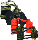 is the 'Real-Time Live Mode'. The live mode enables the user to scan in any direction to locate subsurface anomalies. The uniqueness is the speeds that they are capable of traveling, you can run if you like, with astonishing results and full screen viewing.
The USA technology has been successfully deployed in various climatic and geological conditions by both professionals and amateurs. Applications include archaeology, geophysics, geology, hydrology and treasure hunting. Surveyed areas include industrial waste sites and waste deposits, building lots, mining areas, street construction sites, military practice sites and other sub-surface investigations.
The USA Field Pack was custom-made for the serious professional. Not only 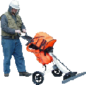 does it come with enough room for your gear, but also for the laptop and control unit plus batteries. The packs are evenly balanced to create comfort with very little body strain. The USA Field Pack comes in an assortment of colors, as well as two sizes depending on the size of the laptop, large or small.
The GeoCaddy is available as an accessory for the Discovery, Imager and Runabout to help maintain even scans while the caddy 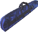 holds all the gear and extra batteries for longer life in the field.
Antenna Case with shoulder strap can accommodate up to 3 antennas for added protection. Available standard with Discovery and Imager packages. Optional for other models.
MagnumRunaboutDiscoveryImagerPre-Configured LaptopxxxxDual Channel Control UnitxxxxField PackxxxxWiring HarnessxxxxCablesxxxxBattery 24VxxxxCharger 24VxxxxSoftwarexxxxVideoxxxxExtension RodxxxxUser ManualxxxxTech SupportxxxxPelican CasexxxxAntenna Case xx10' Antennax 20' Antenna xx 24' Antenna xLiveMode xxxPinpointer xxOptional Antennas12' Antenna xx 20' Antennax 36' Antenna xxxNumber of sensors in antenna depend on unit. Magnum(2), Runabout(4), Discovery(8) and Imager(16).
New Dual Channel Control UnitNew Detection SpeedAutomatic Ground BalancingBoat / Vehicle MountFind Buried TreasureLocate Utilities @ 18MPHSubsurface WaterTunnels / Caves / Voids to 200 FeetOre BodiesPlacer Pay DepositsLocate ShipwrecksMetals and MineralsMining ApplicationsSubsurface AnomaliesNew Updated SoftwareNew 6' and 8' AntennasDemonstrations in Las Vegas / MedfordCompact and LightweightOptional Geocaddy2 Hour Tech Support or Demo/Training includedEasy to Use w/Laptop Computer


 Pinpointer 2.0 ART has been released!
 The Underground Surveyor Apparatus (USA) Multi-Sensor units are a state of the art Multi-Sensor Array that are capable of extraordinary sampling rates producing detailed yet the most efficient results up to 200 feet! The USA are well suited for both the utility locator as well as the Professional Treasure Hunter. The USA has advanced software which makes operating the units much simpler than other brands available, and the software is included with the purchase at no extra charge.
 is the 'Real-Time Live Mode'. The live mode enables the user to scan in any direction to locate subsurface anomalies. The uniqueness is the speeds that they are capable of traveling, you can run if you like, with astonishing results and full screen viewing.
 holds all the gear and extra batteries for longer life in the field.